Dorset Heaths on:
[Wikipedia]
[Google]
[Amazon]

 The Dorset Heaths form an important area of
at www.naturalengland.org.uk. Accessed on 3 Apr 2013.
at www.naturalengland.org.uk. Accessed on 4 Sep 2013
 The land within the Dorset Heaths rises to a maximum of at
 The Dorset Heaths are home to a large number of

 The Dorset Heaths form an important area of
 heathland
A heath () is a shrubland habitat found mainly on free-draining infertile, acidic soils and characterised by open, low-growing woody vegetation. Moorland is generally related to high-ground heaths with—especially in Great Britain—a cooler ...
within the Poole Basin in southern England
England is a country that is part of the United Kingdom. It shares land borders with Wales to its west and Scotland to its north. The Irish Sea lies northwest and the Celtic Sea to the southwest. It is separated from continental Europe b ...
. Much of the area is protected.
Extent
According toNatural England
Natural England is a non-departmental public body in the United Kingdom sponsored by the Department for Environment, Food and Rural Affairs. It is responsible for ensuring that England's natural environment, including its land, flora and fauna, ...
, who have designated the Dorset Heaths as National Character Area 135, the heathlands cover an area of 61,662 hectares, whose boundary runs from Bockhampton and Warmwell
Warmwell is a small village and civil parish in south west Dorset, England, situated on the B3390 road about southeast of Dorchester. In 2013 the estimated population of the parish was 80.
Warmwell contains several historic buildings, includin ...
in the west via Wimborne Minster
Wimborne Minster (often referred to as Wimborne, ) is a market town in Dorset in South West England, and the name of the Church of England church in that town. It lies at the confluence of the River Stour and the River Allen, north of Poole ...
to Fordingbridge
Fordingbridge is a town and broader civil parish with a population of 6,000 on the River Avon in the New Forest District of Hampshire, England, near the Dorset and Wiltshire borders and on the edge of the New Forest, famed for its late medieva ...
in the far northeast. It then turns southwards to Hengistbury Head
Hengistbury Head (), formerly also called Christchurch Head, is a headland jutting into the English Channel between Bournemouth and Mudeford in the English county of Dorset. It is a site of international importance in terms of its archaeology ...
, before following the coastline to Studland and Brownsea Island
Brownsea Island is the largest of the islands in Poole Harbour in the county of Dorset, England. The island is owned by the National Trust with the northern half managed by the Dorset Wildlife Trust. Much of the island is open to the public and ...
then finally heading westwards - north of South Purbeck (with the Purbeck Hills
The Purbeck Hills, also called the Purbeck Ridge or simply the Purbecks, are a ridge of chalk downs in Dorset, England. It is formed by the structure known as the Purbeck Monocline. The ridge extends from Lulworth Cove in the west to Old H ...
) and the Weymouth Lowlands - to the Warmwell area.''NCA 135: Dorset Heaths Key Facts & Data''at www.naturalengland.org.uk. Accessed on 3 Apr 2013.
Character
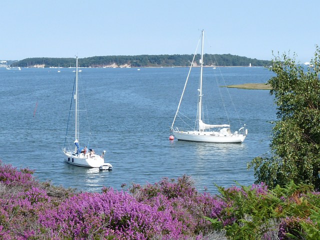
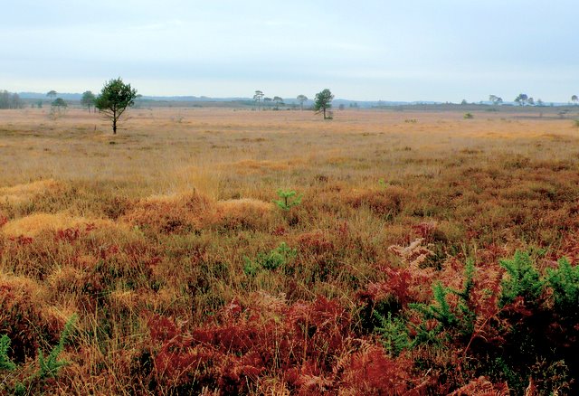
The character of the Dorset Heaths contrasts strongly with its neighbouringnatural region
A natural region (landscape unit) is a basic geographic unit. Usually, it is a region which is distinguished by its common natural features of geography, geology, and climate.
From the ecology, ecological point of view, the naturally occurring fl ...
s. Undulating lowland heath with heather, pine
A pine is any conifer tree or shrub in the genus ''Pinus'' () of the family Pinaceae. ''Pinus'' is the sole genus in the subfamily Pinoideae. The World Flora Online created by the Royal Botanic Gardens, Kew and Missouri Botanical Garden accep ...
s and gorse
''Ulex'' (commonly known as gorse, furze, or whin) is a genus of flowering plants in the family Fabaceae. The genus comprises about 20 species of thorny evergreen shrubs in the subfamily Faboideae of the pea family Fabaceae. The species are n ...
alternates with exposed, open, large-scale farmland
Agricultural land is typically land ''devoted to'' agriculture, the systematic and controlled use of other forms of lifeparticularly the rearing of livestock and production of cropsto produce food for humans. It is generally synonymous with bot ...
, woodland
A woodland () is, in the broad sense, land covered with trees, or in a narrow sense, synonymous with wood (or in the U.S., the ''plurale tantum'' woods), a low-density forest forming open habitats with plenty of sunlight and limited shade (see ...
and scrub. Blocks of conifers form locally prominent landmarks. Apart from the major Poole
Poole () is a large coastal town and seaport in Dorset, on the south coast of England. The town is east of Dorchester and adjoins Bournemouth to the east. Since 1 April 2019, the local authority is Bournemouth, Christchurch and Poole Counc ...
-Bournemouth
Bournemouth () is a coastal resort town in the Bournemouth, Christchurch and Poole council area of Dorset, England. At the 2011 census, the town had a population of 183,491, making it the largest town in Dorset. It is situated on the Southern ...
-Christchurch
Christchurch ( ; mi, Ōtautahi) is the largest city in the South Island of New Zealand and the seat of the Canterbury Region. Christchurch lies on the South Island's east coast, just north of Banks Peninsula on Pegasus Bay. The Avon River / ...
conurbation on the coast, much of the area is sparsely populated with scattered settlements and a few small villages and towns. Valleys are flat-bottomed and open with floodplain
A floodplain or flood plain or bottomlands is an area of land adjacent to a river which stretches from the banks of its channel to the base of the enclosing valley walls, and which experiences flooding during periods of high discharge.Goudi ...
pastures. There is an outer perimeter of low, rolling hills marking the transition to chalk downland
Downland, chalkland, chalk downs or just downs are areas of open chalk hills, such as the North Downs. This term is used to describe the characteristic landscape in southern England where chalk is exposed at the surface. The name "downs" is deriv ...
.''Dorset Heaths''at www.naturalengland.org.uk. Accessed on 4 Sep 2013
Geography
Topography
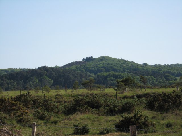
 The land within the Dorset Heaths rises to a maximum of at
 Creech Barrow Hill
Creech Barrow Hill is a steep, conical hill, Ordnance Survey 1:50,000 ''Landranger'' series, no. 195. (one source 637 feet) high, near the coast of Dorset, England, and the highest point of the Dorset Heaths. It has been described as "one of D ...
,Note that Natural England's NCA profile gives the highest point as 174 m, but clearly implies Creech Barrow Hill is part of the NCA. English Nature give the height as 195 m. but the average height is just .
Rivers
Major rivers include theFrome
Frome ( ) is a town and civil parish in eastern Somerset, England. The town is built on uneven high ground at the eastern end of the Mendip Hills, and centres on the River Frome. The town, about south of Bath, is the largest in the Mendip d ...
, Stour, Moors
The term Moor, derived from the ancient Mauri, is an exonym first used by Christian Europeans to designate the Muslim inhabitants of the Maghreb, the Iberian Peninsula, Sicily and Malta during the Middle Ages.
Moors are not a distinct or ...
, Piddle, Sherford, Allen Allen, Allen's or Allens may refer to:
Buildings
* Allen Arena, an indoor arena at Lipscomb University in Nashville, Tennessee
* Allen Center, a skyscraper complex in downtown Houston, Texas
* Allen Fieldhouse, an indoor sports arena on the Unive ...
, Corfe
Corfe is a village and civil parish in Somerset, England, situated below the Blackdown Hills south of Taunton in the Somerset West and Taunton district. The village has a population of 253.
History
The parish of Corfe was part of the Taunton ...
and Dorset Avon.
Main settlements
The largest settlement within the Dorset Heaths is the extensiveSouth East Dorset conurbation
The South East Dorset conurbation (also known as the South Dorset conurbation, Poole-Bournemouth urban area and Bournemouth urban area) is a multi-centred conurbation on the south coast of Dorset in England.
Extent
The main population centre ...
, this includes the large towns of Poole
Poole () is a large coastal town and seaport in Dorset, on the south coast of England. The town is east of Dorchester and adjoins Bournemouth to the east. Since 1 April 2019, the local authority is Bournemouth, Christchurch and Poole Counc ...
, Bournemouth
Bournemouth () is a coastal resort town in the Bournemouth, Christchurch and Poole council area of Dorset, England. At the 2011 census, the town had a population of 183,491, making it the largest town in Dorset. It is situated on the Southern ...
and Christchurch
Christchurch ( ; mi, Ōtautahi) is the largest city in the South Island of New Zealand and the seat of the Canterbury Region. Christchurch lies on the South Island's east coast, just north of Banks Peninsula on Pegasus Bay. The Avon River / ...
. Other significant Satellite towns are Wareham, Fordingbridge
Fordingbridge is a town and broader civil parish with a population of 6,000 on the River Avon in the New Forest District of Hampshire, England, near the Dorset and Wiltshire borders and on the edge of the New Forest, famed for its late medieva ...
and Wimborne Minster
Wimborne Minster (often referred to as Wimborne, ) is a market town in Dorset in South West England, and the name of the Church of England church in that town. It lies at the confluence of the River Stour and the River Allen, north of Poole ...
. The total population for the NCA was 446,296 as of 2001 with an increase to 466,626 following the 2011 censuProtected areas
 The Dorset Heaths are home to a large number of
 protected area
Protected areas or conservation areas are locations which receive protection because of their recognized natural, ecological or cultural values. There are several kinds of protected areas, which vary by level of protection depending on the ena ...
s including:
*Ramsar site
A Ramsar site is a wetland site designated to be of international importance under the Ramsar Convention,8 ha (O)
*** Permanent 8 ha (P)
*** Seasonal Intermittent < 8 ha(Ts)
**
Special Protection Area
A Special Protection Area (SPA) is a designation under the European Union Directive on the Conservation of Wild Birds. Under the Directive, Member States of the European Union (EU) have a duty to safeguard the habitats of migratory birds and cert ...
s: Dorset Heathlands SPA, Poole Harbour
Poole Harbour is a large natural harbour in Dorset, southern England, with the town of Poole on its shores. The harbour is a drowned valley (ria) formed at the end of the last ice age and is the estuary of several rivers, the largest being th ...
SPA, Avon valley SPA
*Special areas of conservation
A Special Area of Conservation (SAC) is defined in the European Union's Habitats Directive (92/43/EEC), also known as the ''Directive on the Conservation of Natural Habitats and of Wild Fauna and Flora''. They are to protect the 220 habitats and ap ...
: Dorset Heaths SAC, Dorset Heaths (Purbeck & Wareham) & Studland Dunes SAC, Isle of Portland
An isle is an island, land surrounded by water. The term is very common in British English. However, there is no clear agreement on what makes an island an isle or its difference, so they are considered synonyms.
Isle may refer to:
Geography
* Is ...
to Studland Cliffs SAC; River Avon SAC.
* National nature reserves: Studland and Godlingston Heath NNR
The Studland and Godlingston Heaths NNR is located on the Isle of Purbeck in the English county of Dorset. It borders Studland Bay on the south side of Poole Harbour, between the settlements of Swanage and Sandbanks. Extending to 631ha, it is ow ...
, Holt Heath NNR; Hartland Moor NNR; Stoborough Heath NNR; Holton Heath
Holton Heath is an area of the parish of Wareham St. Martin, Dorset, England. The area includes a trading estate, on the site of the former Royal Navy Cordite Factory, Holton Heath, (RNCF). East of the trading estate is the Holton Heath Natio ...
NNR; Morden Bog NNR; Arne Reedbeds NNR.
References
{{coord missing, Dorset Natural regions of Dorset Natural regions of England Ramsar sites in England